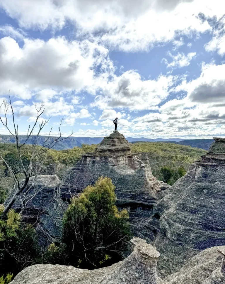
Where is the Lost City in the Blue Mountains? – a question I get asked all the time by people who’ve been scrolling through social media, spotting those wild pagoda rock formations and trying to work out where on earth they are. My name is Paul Beames, and I’ve spent years poking around the sandstone gullies and ridges between the Blue Mountains National Park and the Gardens of Stone State Conservation Area. I can tell you straight up: the Lost City is perched right on the edge of the Newnes Plateau – a crazy maze of dirt tracks, rocky outcrops and platy pagodas, all shaped by wind, rain and a whole lot of time.
It’s remote, raw and bloody worth the trip. This is the kind of place where you’ll often spot a gang of gang-gang cockatoos before you see another soul.
Reaching This Remote Sandstone Wonderland
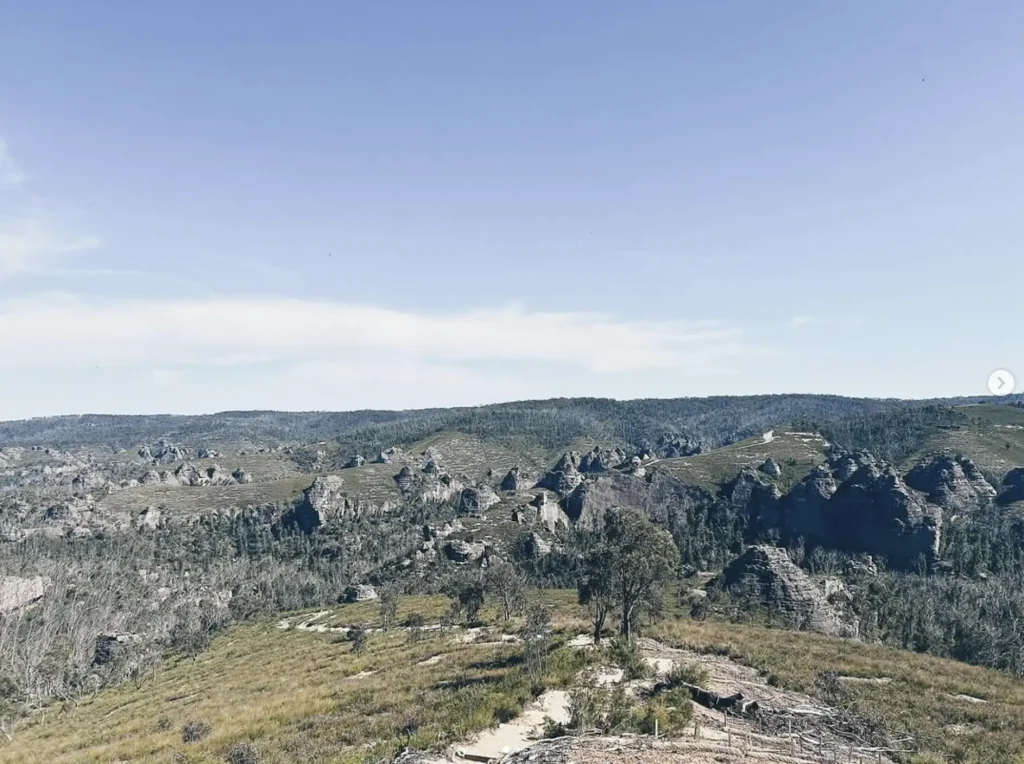
The real adventure starts with getting there. The Lost City is accessed via a network of dirt fire trails branching off Long Swamp Road, weaving through sections of the Newnes State Forest and heading toward the Lost City lookout and the Lost City walk. Track conditions can shift from a bit bumpy to proper rough stuff in a hurry.
After a wet spell, expect creek crossings and some dodgy humps in the road thanks to fire trail work and general wear and tear. Many of these tracks still carry the scars of the Gospers Mountain bushfire, which reshaped large parts of the plateau and prompted the NSW Government and National Parks and Wildlife Service (NPWS) to start planning new visitor infrastructure.
Mobile signal? Forget about it.
Quickie Directions
From Sydney, take the Bells Line of Road towards Clarence.
Then head towards Zig Zag and State Mine Gully Road.
From there, continue onto Long Swamp Road and follow the dirt trail to the Lost City Walking Track access point.
The Lost City walking track visitor information is a handy resource for checking closures, conditions and the latest NPWS updates.
Why These Ancient Rock Towers Stand Out
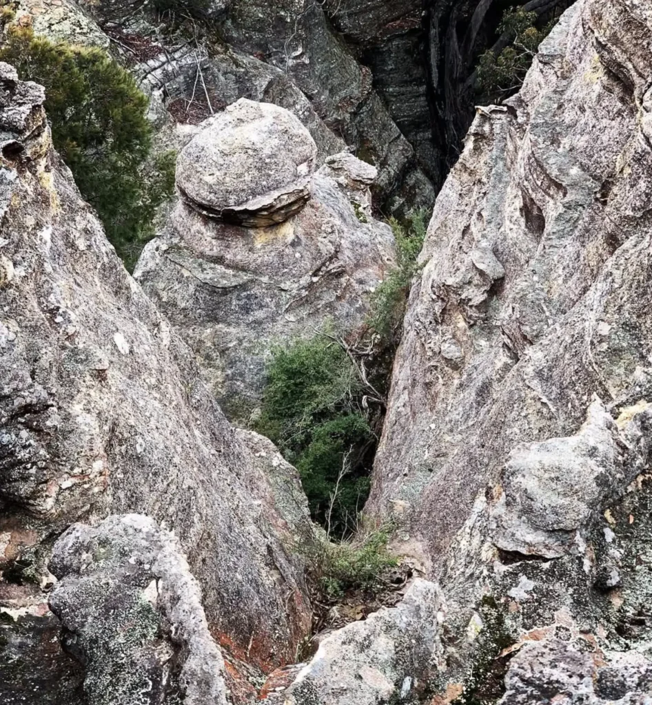
The Lost City is famous for its mind-blowing pagoda structures – beehive-shaped sandstone towers that look like stacked apartment blocks capped with thatched roofs. These formations sit right where old river delta sediments meet eroded Tertiary basalt, and that mix slowly breaks down into those distinctive rings over time.
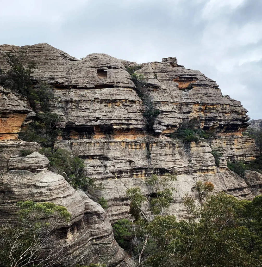
Some of the pagodas hide tiny cave chambers inside, while others stand alone like giant sandstone chimneys. Keep an eye out for those that stand guard over the Marrangaroo Creek country. Flora surveys regularly turn up Dwarf Snow Gum and other hardy bush species clinging to shallow soils for dear life.
This is delicate terrain, so take care and tread lightly.
What Makes The Pagodas Unique?
- They’ve been shaped by millions of years of the weather working its way through layered sandstone – it’s an incredible sight to see.
- You’ve got Snow Gum Flora Reserve pockets, rare and unique, plus all sorts of other flora and fauna surveys coming in.
- This place is part of a broader geological corridor stretching all the way to Wollemi National Park – it’s just one of those natural wonders.
Conditions You’ll Want To Prepare For
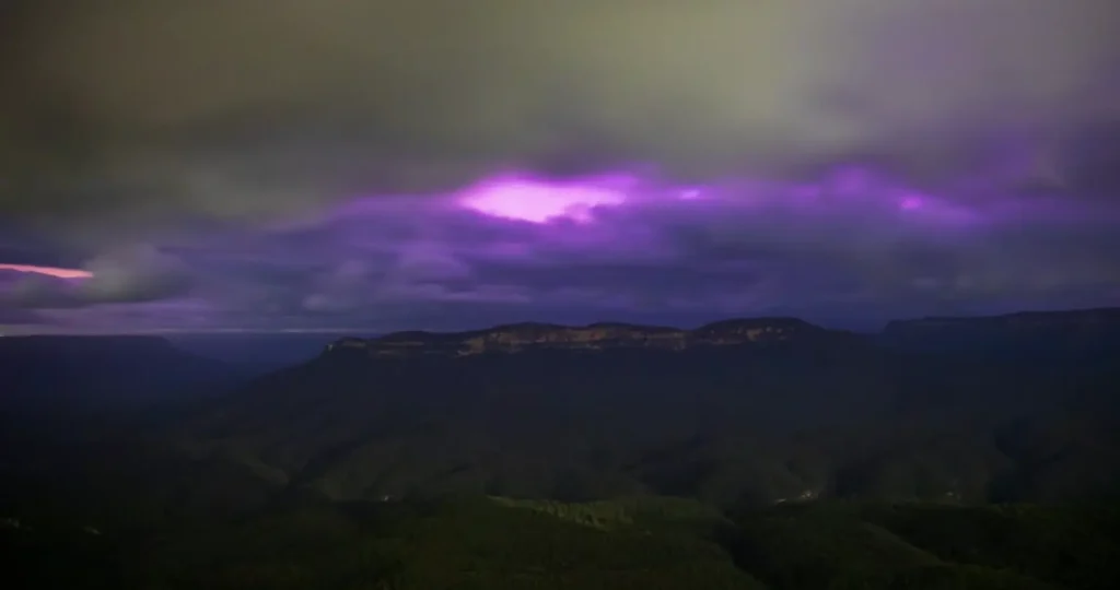
The plateau climate is a bit of a beast when you get up to the Lost City Viewpoint – the wind just howls in straight off the escarpment, and then before you know it, you’re caught in a fog bank, and the fire trails are all but gone. And of course, the Snow Gum areas can frost really early, and you’ll be lucky to avoid the moisture in the shaded gullies like Miners Pass Track altogether.
I’ve had my fair share of scraping ice off my swag in this place – you get used to it eventually.
How The Seasons Change Your Trip
- Summer: The heat and dust can be suffocating, but don’t be fooled – those sudden storms can turn the Lost City Trail into a mud trap in no time.
- Autumn: Crisp, clear air, and to top it all off, the tracks are perfect for taking in the views from the clifftops and all.
- Winter: The fog rolls in, and the mornings are icy, and the visibility around those pagoda rock formations is about as bad as it gets.
- Spring: Be on the lookout for the wildflowers blooming near the Bungleboori picnic area, and you’ll be lucky if you catch a glimpse of the ones poking out from the higher Snow Gum areas.
Lost City Weather Snapshot (Averages)
| Season | Day Temp (°C) | Night Temp (°C) | Rain Likelihood | Track Conditions |
|---|---|---|---|---|
| Summer | 22–30° | 12–18° | High storms | Dusty → boggy fast |
| Autumn | 15–23° | 5–12° | Moderate | Stable overall |
| Winter | 5–12° | -2–4° | Low | Icy, icy patches |
| Spring | 15–25° | 5–10° | Moderate | Variable |
Bush-Smart Tips For Exploring The Plateau
Travelling the Newnes Plateau isn’t tough, but you’ll want to be ready. Fire trails change after storms, and the Miners Track/Miners Pass trails can shift too – either because of maintenance or erosion. And if you want to stay informed, then the NPWS visitor alerts are like having a local guide in your pocket.
Navigation Tips That Save You From A GPS Fail
- Download the offline maps for Glow Worm Tunnel Road and the Lost City Adventure Experience – it never hurts to have a safety net.
- Fire trails fork off in unexpected places, so make sure you mark your turn-offs so you don’t get confused later.
- Tell someone roughly where you’re headed – you never know when a poor reception might turn a minor issue into a bigger one.
Gear That Makes Life Easier
- A proper 4WD that can handle those bumpy, rocky outcrops and erosion mounds.
- A recovery kit for those tricky sand pockets near Bungleboori Creek and Marrangaroo Creek – you don’t want to get stuck.
- And don’t forget a good pair of boots – the pagoda structures can be fragile, so tread carefully.
A Nearby Attraction Worth The Detour
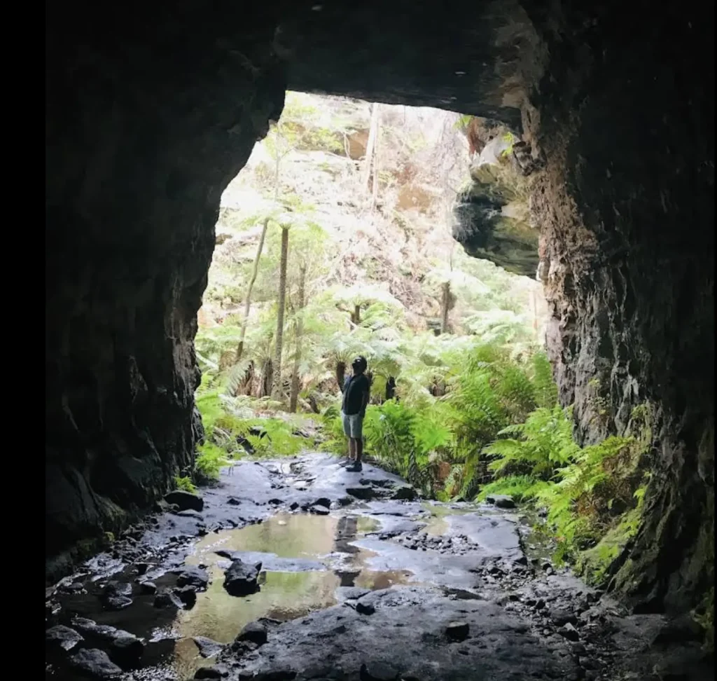
If you’re already exploring Glowworm Tunnel Road, the famed tunnel is only a short side mission from the plateau. The Glow Worm Tunnel sits between old coal mine ruins and heritage dams once linked to the power station and early industrial works of the Newnes area.
The tunnel itself, once part of a railway ventilation shaft network, still carries echoes of industrial history — and now glimmers with glow worms that thrive in the pitch dark. Close by, you’ll find the Bungleboori Camping Ground and picnic spaces, making it a natural add-on to the Lost City loop.
A Realistic Look At Safety Out Here
Short answer: As long as you’re not completely reckless and your vehicle is in good nick, then you should be okay. The Lost City Walking Track and surrounding fire trails aren’t too technical, but they are pretty remote. There are rock walls that can come loose unexpectedly, and creek crossings near Marrangaroo Creek can swell up after a storm. And then there’s the old mining infrastructure from the coal mine era that’s still scattered around the place – just treat those heritage sites with a bit of respect.
Risks To Consider
- The edges around the pagodas and clifftop tracks can be a bit dodgy.
- Suddenly, thick fog can roll in from the Mt Wilson and Mt Irvine direction out of nowhere.
- Some parts of the track still haven’t fully recovered from the Gospers Mountain bushfire.
- Plus, changes to the track due to visitor infrastructure and natural erosion – it’s always worth keeping an eye out for those.
Before You Hit The Tracks
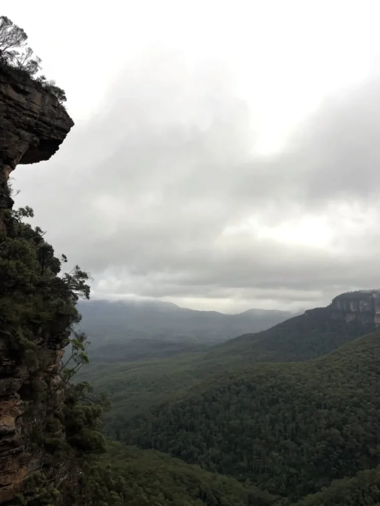
The Lost City – its all-sandstone, storm-sculpted heart and soul shaped by the rich history of the Aboriginal people, the coal mining industry’s legacy and the modern-day effort to build visitor infrastructure that actually respects the heritage of the place – that’s what you’ll experience if you head out there. Be prepared, tread easily on the fragile structures that dot the landscape and soak up the silence that only miles of open country can bring.
If you’ve done one of those Blue Mountains day tour from Sydney and been left wanting more than just the usual viewpoints, then this rugged plateau is precisely where the Wildlife Tours guides will want to take you to stretch your legs and see a bit more of the great outdoors.
FAQ
Do you really need a 4WD to get to the Lost City?
Yep, definitely. Those fire trails that lead to the Lost City lookout and the tracks around the place demand a vehicle with clearance and some serious traction. Standard 2WDs just won’t make the journey safely, trust us.
Is it a bad idea to visit after a heavy downpour?
Not if you want to have a nasty time, that is. The creek crossings around Marrangaroo Creek and Bungleboori aren’t going to be fun to cross when they’re swollen from rain. And don’t even get us started on Glow Worm Tunnel Road – that road gets pretty soft pretty quickly.
Can we camp right at the Lost City?
Sorry, no. There are no campsites right at the Lost City itself. But if you do your research – and are aware of the heritage values and cultural sensitivities of the area – you can find some dispersed camping spots around Newnes Plateau and Bungleboori. Just keep in mind that you’ll need to pack out all your waste and be super considerate of your surroundings.
Are there any facilities around there?
Nope. No water, no toilets, no bins. You’ll need to pack out all your rubbish and take care of all your own business.
Is the Lost City actually in a National Park?
The Lost City walking track is in Gardens of Stone State Conservation Area on the Newnes Plateau, managed by NSW National Parks and Wildlife Service.